Discover how Islamic geographers like Al-Khwarizmi and Al-Biruni revolutionized world mapping by integrating Greek, Persian, and Indian knowledge.
How figures like Piri Reis and Muhammad al-Idrisi influenced European explorers.
Dive into the innovations that shaped both Islamic and European cartography, including the transformative 18th-century printing press by Ibrahim Muteferrika.
Pioneers of Islamic Cartography
Islamic cartographers like Al-Khwarizmi and Al-Biruni frequently revolutionized mapmaking by integrating diverse scientific and cultural knowledge into their meticulous charts. Their contributions during the medieval period laid the groundwork for modern cartography.
Al-Khwarizmi, a prominent 9th-century figure, compiled astronomical tables and geographical coordinates that became foundational texts in mathematical geography and cartography. His work on the 'Kitab Surat al-Ard' offered one of the earliest detailed maps of the known world, blending Greek, Persian, and Indian knowledge.
Al-Biruni, in the 11th century, further enhanced the precision of medieval maps. His exceptional skills in mathematical geography allowed him to calculate the Earth's radius with remarkable accuracy, showcasing the advanced understanding Islamic geographers had of the world's dimensions. Unlike many of his contemporaries, Al-Biruni also considered cultural contexts, incorporating information from diverse sources, including Hindu scholars.
As you explore the contributions of these pioneering Islamic geographers, you'll see how their innovative methods and integration of varied scientific traditions influenced not only their contemporaries but also subsequent generations. Their meticulous work transcended borders, influencing both Muslim and European cartographers, and set the stage for the dazzling advancements in mapmaking that followed.
Innovations in Latitude Calculation
You'll find that Islamic geographers, like Al-Khwarizmi and Al-Biruni, revolutionized latitude measurement techniques by correcting errors in the length of the Mediterranean Sea. They meticulously compiled tables of latitudes for major cities and refined estimates of the Earth's circumference.
These innovations not only advanced Islamic cartography but also laid the groundwork for European geographic studies.
Latitude Measurement Techniques
During the Golden Age of Islam, astronomers like Al-Khwarizmi and Al-Biruni revolutionized latitude measurement techniques by refining calculations and correcting geographic errors. These Islamic astronomers transformed how latitudes and longitudes were determined, providing a foundation for accurate mapping.
Al-Khwarizmi, in the 9th century, compiled a detailed list of latitudes and longitudes for over 2,400 localities. His work corrected many errors from previous Greek and Roman sources, ensuring more precise geographic data. This meticulous compilation provided a reliable reference for future explorations and map-making endeavors.
Moving into the 11th century, Al-Biruni's contributions were monumental. Not only did he accurately calculate the Earth's radius using sophisticated mathematical techniques, but he also developed methods to ascertain latitudes through observations of the Sun's altitude at noon. These advancements enabled more accurate positioning and mapping of regions, fostering a deeper understanding of the world's geography.
Correcting Mediterranean Errors
Pioneering astronomers like Al-Khwarizmi and Al-Biruni tackled and corrected significant errors in the estimated length of the Mediterranean Sea, transforming the field of geographic calculation. Their meticulous work in latitude calculation was instrumental in pinpointing the true dimensions of the Mediterranean, a critical error that had plagued earlier maps.
Al-Khwarizmi, in the 9th century, compiled tables of latitudes for major cities, which provided a more accurate framework for geographers. His work laid the foundation for others, including Al-Biruni, who made groundbreaking strides in the 11th century. Al-Biruni's precise calculation of the Earth's radius was a cornerstone achievement, influencing how distances and locations were plotted.
The innovations didn't stop there. Al-Idrisi, in the 12th century, further refined these calculations, offering various estimates of the Earth's circumference that deepened the understanding of our world. The correction of errors in the Mediterranean Sea's length had a ripple effect, enhancing the accuracy and precision of maps across the Islamic world.
Through their advancements, these astronomers didn't just correct mistakes; they revolutionized latitude calculation, ensuring that future maps were grounded in scientific accuracy. Their contributions remain a testament to the power of rigorous scholarship.
Influential Islamic Maps
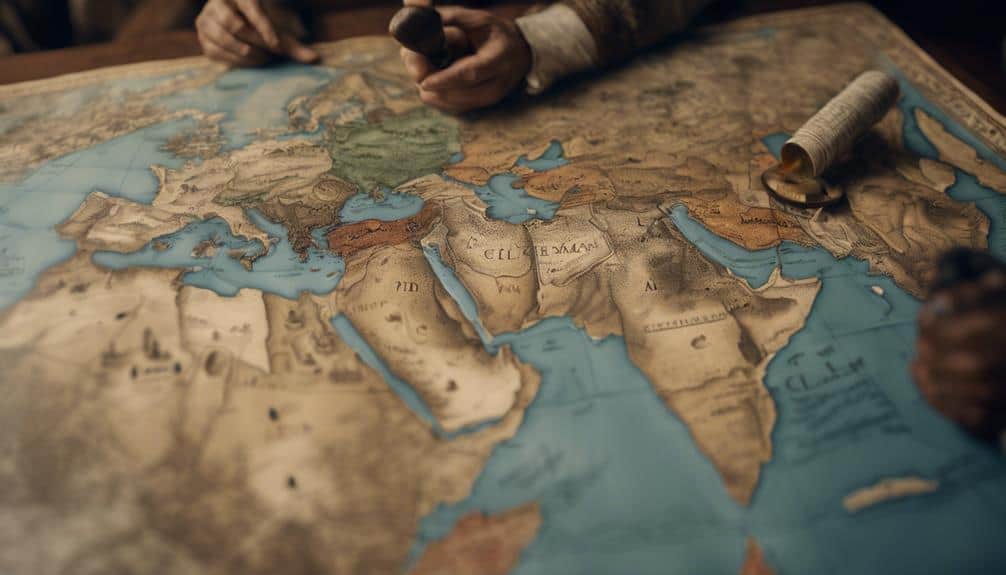
In the field of cartography, Islamic geographers not only mapped their known world with remarkable precision but also influenced subsequent European mapmaking through their detailed and innovative works. One of the most renowned examples is the Piri Reis map, created in 1513. This medieval Islamic map is celebrated for its advanced depiction of the western hemisphere, including Cuba, Hispaniola, and Cipango.
To better understand the influence of Islamic maps, consider the following:
- Accuracy: Piri Reis's maps were so precise that European explorers relied on them for navigation.
- Innovation: Islamic geographers incorporated new discoveries, such as the Americas, demonstrating their adaptability.
- Cultural Exchange: European mapmakers, like the Blaeu family and Adam Olearius, integrated Islamic details into their works.
The Piri Reis map is preserved in Istanbul and serves as a testament to the advanced cartographic techniques of medieval Islamic geographers. Their contributions laid the groundwork for more accurate and inclusive global maps.
The influence can be seen in the Dutch East India Company's detailed maps of India, Persia, and Arabia, which included insights from Islamic sources. By examining these maps, you gain a deeper appreciation of how Islamic cartography bridged cultures and expanded the horizons of world geography.
Key Islamic Geographers
When delving into the domain of Islamic geography, one can't overlook the monumental contributions of figures like Al-Khwarizmi, whose work 'Kitab Surat al-Ard' corrected Ptolemy's errors and greatly advanced the field. Al-Khwarizmi's influential text laid the groundwork for future Muslim geographers by providing more accurate world maps and geographical data during the medieval Islamic period.
Muhammad al-Idrisi, another pivotal figure, created the Tabula Rogeriana in the 12th century, a world map that was remarkably precise for its time. His work reflected a deep understanding of both the physical and cultural landscapes, bridging the knowledge of the East and West.
In the 16th century, Piri Reis, an Ottoman cartographer, produced detailed sea charts and maps that were invaluable for navigation. His maps included parts of the New World, showcasing the extensive reach and curiosity of Islamic geographers.
Earlier figures like Abu Zayd al-Balkhi and Al-Masudi also made significant contributions. Al-Balkhi introduced the concept of 'Balkhi School' maps, which combined geographical and climatic data. Al-Masudi, often called the 'Herodotus of the Arabs,' provided rich historical and geographical narratives.
Ibn Battuta, a 14th-century explorer, left behind thorough travel accounts, offering invaluable insights into the diverse regions of the medieval Islamic world. These geographers collectively expanded the horizons of their time, leaving a lasting legacy.
Printing and Dissemination
The establishment of the first Islamic printing house by Ibrahim Muteferrika in 1729 marked a pivotal moment in the dissemination of geographic knowledge throughout the Islamic world. By harnessing the power of the printing press, Muteferrika facilitated the widespread distribution of important works, such as the 'Cihannuma of Katip Celebi' and the 'Cedid Atlas' by Mahmud Raif Efendi.
This advancement was monumental for a few key reasons:
- Enhanced Accessibility: Geographic knowledge, previously confined to a select few, became more accessible to scholars and the public.
- Standardization: The printed maps and texts ensured a consistent dissemination of accurate information.
- Educational Integration: Modern geographic information was integrated into educational and administrative spheres, reflecting the Ottomans' 'Nizam-i Cedid' reforms.
Printing in Arabic script, authorized in the early 18th century, allowed for the seamless transmission of this knowledge. The advancements in printing technology greatly boosted the visibility of Islamic cartography.
Establishing Islamic printing houses and the authorization of printing in Arabic script made geographic knowledge and maps widely available. This period marked an era where the Islamic world could preserve, standardize, and share their rich geographic heritage, enhancing both scholarly pursuits and administrative functions.
Cultural and Technological Impact
Islamic geographers' intricate blend of cultural insights and technological advancements revolutionized the way the world was mapped and understood. During the medieval period, Islamic cartographers created detailed maps that incorporated knowledge from various cultures, profoundly impacting global geography. These medieval Islamic maps weren't just geographical tools but also cultural artifacts that reflected the interconnectedness of the Islamic world with other regions.
Technological advancements in cartography by Islamic scholars influenced European explorers and mapmakers. The Dutch East India Company, for instance, used precise maps of the Coast of Coromandel in India to control trade routes and establish trading posts. European cartographers like the Blaeu family integrated this newfound information into their maps of India, Persia, and Arabia.
The accuracy of medieval Islamic maps provided a foundation for later European explorations. Adam Olearius's travels to Persia yielded maps of the Caspian Sea that were potentially influenced by earlier Islamic geographers. Even Piri Reis's 1513 world map, which depicted parts of the western hemisphere, highlighted the advanced state of Islamic cartography.
These influences reached far, even impacting Christopher Columbus and his contemporaries, who relied on the precision and detail of existing maps to navigate new territories.


